
Article-At-A-Glance
- Solar-powered drones can cover vast areas of farmland in a single flight, collecting data faster and more accurately than any manual scouting method.
- Farms using drone-guided irrigation optimization report energy savings of 20–35%, extending the effective capacity of existing solar installations.
- Agricultural drones are equipped with thermal imaging, LiDAR, and multispectral sensors — and knowing which sensor does what could be the difference between saving and losing a crop.
- Solar drones aren’t just for crops — they’re also transforming how farmers inspect and maintain solar panel arrays on their properties.
- The cost of entry is dropping fast, but choosing the wrong drone for your operation is still an expensive mistake — here’s what to look for.
Solar-Powered Drones Are Changing How Farmers Work
By the Numbers: Solar-powered drones collect field data faster, cover more ground per flight, and reduce operational costs compared to both manual inspection and traditionally battery-powered UAVs — all while producing zero direct emissions during operation.
Not long ago, checking on crop health meant walking fields row by row. For large operations spanning hundreds or thousands of acres, that process was slow, expensive, and almost always incomplete. A farmer might spot a problem in one section while an equally serious issue went unnoticed three fields over.
Solar-powered drones change that equation entirely. Instead of reactive problem-solving, farmers can shift to proactive crop management — identifying issues before they become losses. These UAVs (unmanned aerial vehicles) are fitted with solar panels that continuously recharge onboard systems during flight, dramatically extending how long they can stay in the air compared to standard battery-only drones.
The result is a technology that doesn’t just save time. It fundamentally changes how decisions are made on the farm — faster, with better data, and at a fraction of the traditional cost. For instance, using drone solar panel monitoring can significantly enhance efficiency and revenue protection.
How Solar-Powered Drones Actually Work
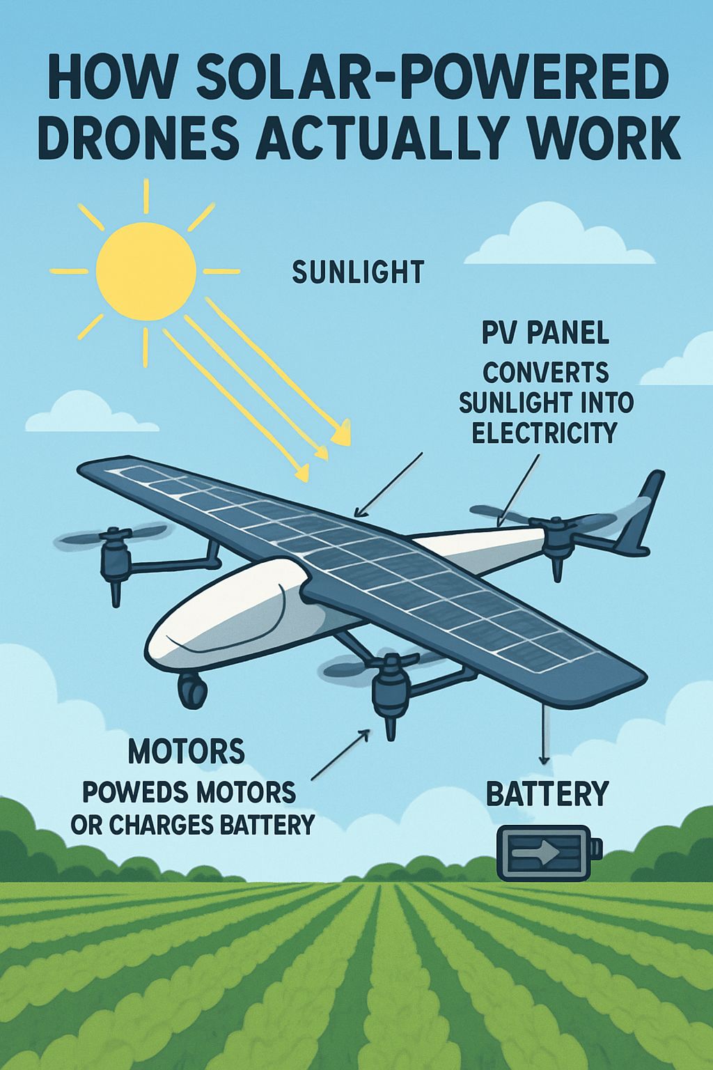
At their core, solar-powered agricultural drones are UAVs with photovoltaic (PV) panels integrated into the wing or body surface. These panels convert sunlight into electricity, which either powers the drone’s motors directly or charges onboard batteries that supplement flight. The dual-source power system is what makes extended flight times possible — even when cloud cover temporarily reduces solar input, the battery buffer keeps the drone airborne. For a deeper understanding, explore how solar-powered drones enhance energy efficiency.
Solar Panels on Drones: The Basic Setup
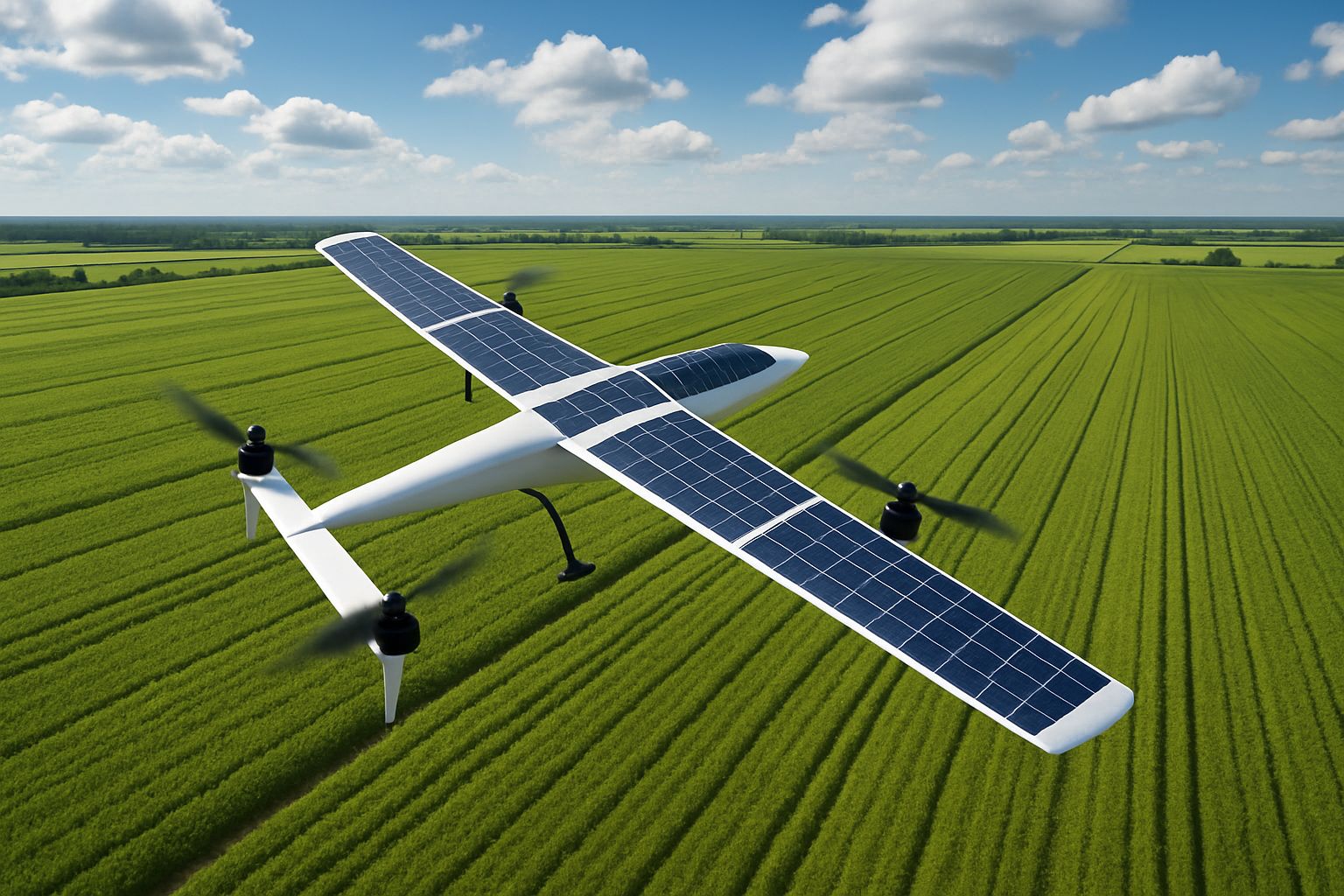
The solar panels used on agricultural drones are typically thin-film or monocrystalline silicon cells, chosen for their high energy-to-weight ratio. Every gram matters in drone design, so manufacturers engineer the panels to lay flush with aerodynamic surfaces — most commonly fixed-wing drone bodies — rather than adding bulk. Fixed-wing solar drones like the AtlantikSolar AS-2 use this approach to achieve multi-hour flight endurance, making them well-suited for large-scale farm surveys.
Multi-rotor solar drones also exist, though they consume significantly more power to maintain lift. As a result, most heavy-duty agricultural solar drones lean toward fixed-wing or hybrid VTOL (vertical take-off and landing) designs that combine the efficiency of fixed-wing flight with the flexibility of vertical launch — no runway required.
How Long Can a Solar Drone Stay in the Air?
Flight time is one of the most important metrics for agricultural use. Standard battery-powered agricultural drones typically fly for 20–40 minutes per charge. Solar-assisted models extend this significantly — some fixed-wing solar UAVs are capable of flights lasting several hours under good sunlight conditions, allowing them to survey thousands of acres in a single mission without landing to swap batteries. Current solar drone models still face limitations in payload capacity compared to purely battery-powered alternatives, so flight endurance and sensor load need to be balanced carefully when selecting a system.
What Sensors Do Agricultural Drones Use?
The drone itself is only part of the story. What makes agricultural UAVs genuinely powerful is the sensor payload they carry. Most commercial agricultural drones support a modular sensor system, and the choice of sensor determines what kind of data you get back. Here’s a breakdown of the most common sensor types and what each one is actually used for:
- High-Resolution RGB Cameras — Standard visual imaging for general crop inspection, field mapping, and growth stage documentation.
- Multispectral Sensors — Capture light beyond the visible spectrum to detect chlorophyll levels, plant stress, and early signs of disease that are invisible to the naked eye.
- Thermal Imaging Sensors — Measure surface temperature variation across a field to identify irrigation failures, drainage problems, and areas of water stress.
- LiDAR (Light Detection and Ranging) — Uses laser pulses to generate precise 3D terrain maps, useful for drainage planning, slope analysis, and canopy height measurement.
- Hyperspectral Sensors — A more advanced version of multispectral imaging that captures hundreds of narrow wavelength bands, enabling detailed soil composition and pest identification analysis.
Crop Monitoring from Above: What Drones Can See That You Can’t
The human eye is a remarkable instrument, but it has real limitations when it comes to crop health assessment. Many of the most damaging threats to a crop — early-stage fungal infections, sub-surface soil moisture loss, the beginning of a pest infestation — show no visible symptoms until significant damage has already occurred. By the time you can see the problem walking a field, you may have already lost yield. For instance, drone inspections can reveal issues that are not visible to the naked eye, offering a proactive approach to crop management.
Drone-mounted sensors pick up these signals weeks earlier. Multispectral imaging, for example, detects changes in the way plants reflect near-infrared light — a shift that happens at the cellular level before any visible wilting, discoloration, or die-off appears above ground. This early-warning capability is arguably the single most valuable thing an agricultural drone can offer a working farm. For more insights on this technology, explore how solar-powered drones are transforming agriculture.
Detecting Pest Infestations Early
Pest pressure is one of the most unpredictable and costly challenges in crop production. A drone equipped with high-resolution RGB and multispectral sensors can identify the irregular crop patterns and stress signatures that accompany early pest activity — localized areas where plant vigor drops suddenly compared to surrounding growth. Catching this at the 2–5% field impact stage rather than the 30–40% stage is the difference between a targeted treatment and a full-field intervention.
Some advanced systems also integrate AI-powered image analysis software that flags anomalies automatically after each flight, generating zone-specific alerts that direct ground crews precisely where to investigate. This takes the guesswork out of scouting entirely.
Spotting Nutrient Deficiencies Before Crop Loss Occurs
Nutrient deficiencies follow predictable spectral signatures. Nitrogen deficiency, for instance, causes a measurable reduction in chlorophyll that shows up in multispectral NDVI (Normalized Difference Vegetation Index) maps before any yellowing is visible at ground level. A drone survey early in the growing season can produce variable-rate fertilizer application maps that direct product exactly where it’s needed — reducing input costs while protecting yield potential across the entire field.
Thermal Imaging for Irrigation Problems
Thermal sensors are the most direct tool for diagnosing irrigation system performance. A properly irrigated crop maintains relatively consistent canopy temperature across a field. When a drip emitter clogs, a pivot section fails, or a section of field drains too quickly, the thermal signature changes — stressed, under-watered plants run hotter than healthy ones. A single thermal drone pass over a field after an irrigation cycle will reveal every underperforming zone with high precision, allowing targeted repairs before crop stress sets in.
This application alone can pay for a drone system quickly on operations with large or complex irrigation infrastructure — particularly when combined with solar-powered irrigation systems where efficiency losses compound over an entire growing season.

How Drones Improve Solar Panel Efficiency on Farms
Solar panels are increasingly common on working farms — powering irrigation pumps, grain dryers, cold storage, and even EV charging for farm equipment. But a solar array that isn’t performing at full capacity is silently costing money every single day, and the traditional method of finding underperforming panels involves walking rows with a handheld thermal camera or waiting for a noticeable drop in energy output. That’s slow, labor-intensive, and often inaccurate.
Drones solve this problem decisively. A single drone flight over a solar array — equipped with a thermal imaging sensor — can generate a complete performance map of every panel in minutes. What would take a ground crew hours to inspect manually gets done in one automated pass, with higher accuracy and a permanent digital record for comparison over time.
Aerial Inspection of Solar Panels vs. Manual Inspection
Manual solar panel inspection has three core problems: it’s slow, it’s dangerous on roof-mounted or elevated arrays, and it’s inconsistent. A technician with a handheld thermal camera can only measure one panel at a time, and human fatigue introduces error over long inspection sessions. For a farm with a 200–500 panel array, a full manual inspection might take an entire day — and even then, subtle performance degradation can go undetected.
Drone-based inspection changes the time equation dramatically. A UAV equipped with a calibrated thermal sensor can survey a 500-panel array in under 30 minutes, capturing every panel simultaneously and generating a georeferenced thermal map that pinpoints hotspots, delamination, bypass diode failures, and soiling patterns with spatial accuracy down to individual cells.
The data quality difference is just as significant as the time savings. Drone-captured thermal imagery is consistent across the entire array because it’s captured under identical environmental conditions in a single pass — eliminating the variability that comes from a multi-hour manual inspection conducted as sunlight angles shift throughout the day.
|
Inspection Method |
Time for 500-Panel Array |
Accuracy |
Safety Risk |
Data Record |
|---|---|---|---|---|
|
Manual (Handheld Thermal) |
6–8 hours |
Variable |
High (elevated arrays) |
Inconsistent |
|
Drone (Thermal UAV) |
20–30 minutes |
High & consistent |
Minimal |
Georeferenced digital map |
Beyond the efficiency gains, the digital record created by drone inspections has real financial value. A timestamped, georeferenced thermal map of your array creates a performance baseline that makes it easy to identify degradation trends over multiple seasons — catching issues before they compound into significant energy losses.
Using Thermal Cameras to Find Underperforming Panels
When a solar panel develops a fault — whether it’s a cracked cell, a failing bypass diode, or localized soiling — that section generates heat instead of electricity. On a thermal image, these faults show up as bright hotspots against the cooler background of normally operating panels. A thermal drone can detect temperature differentials as small as 0.1°C, making it sensitive enough to identify partial shading losses and early-stage cell degradation that produce only minor temperature signatures. For farms where solar energy offsets significant operational costs, catching even a 3–5% efficiency loss early can translate into meaningful annual savings across a large array.
Precision Agriculture: Using Drone Data to Cut Costs
Precision agriculture is built on one idea: apply the right input, in the right amount, in the right place, at the right time. Drone data makes that possible at a scale and resolution that ground-based sensors and satellite imagery simply can’t match. The combination of frequent flights, high-resolution sensors, and AI-driven analysis software turns raw aerial data into actionable field prescriptions that directly reduce input costs while protecting or improving yields.
Optimizing Fertilizer and Pesticide Application
Variable-rate application is one of the most immediately profitable outcomes of agricultural drone data. Instead of applying fertilizer or pesticide uniformly across an entire field — which over-treats healthy areas and may still under-treat problem zones — drone-generated NDVI maps create zone-specific application prescriptions. These prescriptions feed directly into variable-rate spreaders and sprayers, automating the adjustment process field by field. Operations that implement drone-guided variable-rate fertilizer programs consistently report meaningful reductions in total input volume without yield penalties, since product is concentrated where the crop actually needs it.
Building Irrigation Maps from Aerial Data
An irrigation map built from drone data is fundamentally different from one drawn from soil type records or historical averages. It reflects what’s actually happening in your field right now — which zones are retaining moisture, which are draining too fast, and where your irrigation infrastructure is delivering water unevenly. Thermal and multispectral data from a single drone flight can produce a detailed soil moisture variability map across hundreds of acres in a format that integrates directly with modern precision irrigation control systems.
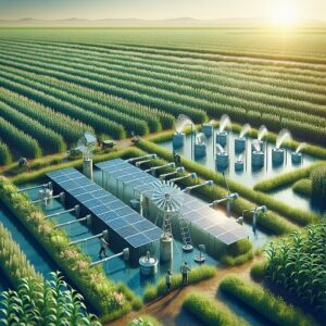
For farms running solar-powered irrigation systems, this matters even more. Every inefficiency in water distribution is also an inefficiency in how your solar energy is being used. Drone-guided irrigation mapping ensures the energy your panels generate is directed toward actual crop need — not compensating for system losses or over-irrigating areas that don’t require it.
How Drone Data Reduces Water Usage by Up to 30%
The 20–35% water and energy savings reported by farms implementing drone-guided irrigation optimization aren’t theoretical — they come from eliminating the systematic inefficiencies that blanket irrigation approaches build in by default. When every irrigation decision is backed by high-resolution aerial data showing exactly where water stress exists and where soil is already at adequate moisture levels, over-application drops sharply.
This reduction compounds over a growing season. Less water applied means lower pumping loads on solar systems, which extends the effective capacity of existing solar installations without adding panels. For operations where water cost or water availability is a limiting factor, drone-guided irrigation optimization is one of the fastest-payback technology investments currently available in production agriculture.
What to Look for When Choosing an Agricultural Drone
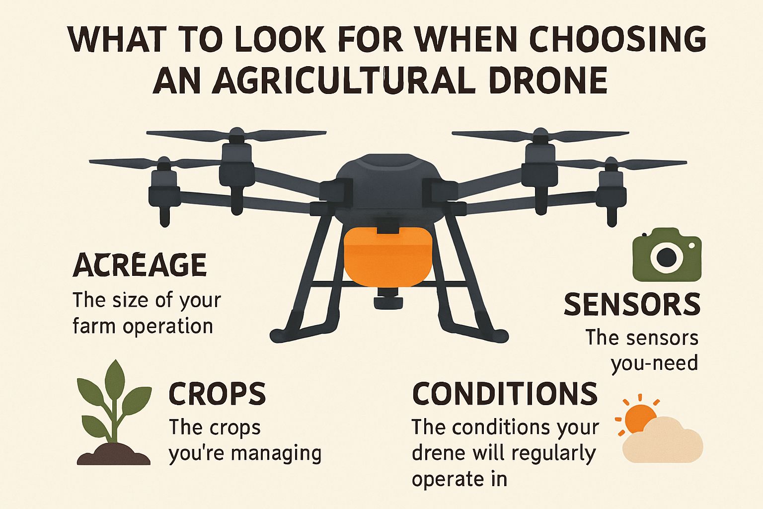
Not every agricultural drone on the market is suited for every farm operation. The right choice depends on your acreage, the crops you’re managing, the sensors you need, and the conditions your drone will regularly operate in. For more insights, you might want to explore how solar-powered drones can enhance your farm operations. Here’s what actually matters when evaluating your options.
Flight Time and Battery Capacity
Flight time is the single most operationally important spec on an agricultural drone. A drone that can only fly 20 minutes per battery requires constant operator intervention on large acreage, significantly increasing labor time and reducing the cost-effectiveness of every flight. For operations over 500 acres, a minimum of 40–50 minutes of flight time per charge should be considered the baseline — and solar-assisted models that extend this further deserve serious consideration for large-scale operations.
Battery capacity also affects how much payload weight the drone can carry. Heavier sensors — particularly LiDAR units and hyperspectral cameras — reduce flight time, so the balance between sensor capability and endurance needs to match your actual workflow. A drone with a 60-minute flight time carrying a lightweight multispectral sensor will often outperform a higher-spec model that’s weighed down to 25 minutes of endurance in real field conditions.
Solar charging integration adds another layer to this calculation. Fixed-wing solar drones like those in the senseFly eBee family are capable of extended coverage missions precisely because solar input reduces the net power draw during flight — making flight time less dependent on battery size alone and more dependent on total mission energy balance.
Flight Time Quick Reference:
• Under 30 min — Suitable for small plots, targeted inspections only
• 30–50 min — Workable for mid-size operations with battery swap logistics
• 50+ min (solar-assisted) — Best suited for large-scale farm surveys, solar array inspection, and multi-field missions
• Multi-hour (fixed-wing solar) — Optimal for operations exceeding 1,000 acres or requiring continuous monitoring capability
Sensor Compatibility for Farm Use
A drone is only as useful as the sensors it can carry, and sensor compatibility varies significantly between platforms. Before purchasing, confirm that your target drone supports the specific sensor types your operation requires — and that the manufacturer’s ecosystem includes the data processing software needed to turn raw sensor output into actionable field maps. Platforms like the DJI Agras T40 and DJI Matrice 350 RTK offer broad sensor compatibility and a mature software ecosystem, while more specialized agricultural platforms like the Parrot Sequoia+ system are optimized specifically for multispectral data collection workflows.
Durability in Farm Environments
Farm environments are genuinely harsh on equipment. Dust, humidity, chemical spray drift, sudden weather changes, and the physical demands of field operations all take a toll on precision electronics. A drone that performs flawlessly in a controlled demo environment may fail within a season under real working conditions. When evaluating durability, the key specs to check are IP (Ingress Protection) rating, frame material, and manufacturer warranty terms for agricultural use.
Durability Specs That Matter in Agricultural Drones:
• IP Rating: Look for IP43 or higher — IP55 and above provides protection against dust ingestion and water spray from irrigation systems or light rain
• Frame Material: Carbon fiber composite frames offer the best strength-to-weight ratio and resist corrosion from fertilizer and pesticide exposure
• Motor Sealing: Sealed brushless motors prevent chemical dust and moisture from degrading performance over time
• Propeller Design: Quick-release, replaceable propellers reduce downtime when field debris causes damage
• Operating Temperature Range: Confirm the drone is rated for the temperature extremes typical of your region — both summer heat and early-season cold
The DJI Agras T40 is a good reference point for agricultural durability standards — it carries an IP67 rating, meaning it’s fully dust-tight and can handle water immersion at shallow depth. That level of protection is overkill for most survey drones but sets the bar for spray application platforms operating in the harshest on-farm conditions.
Beyond the IP rating, consider the availability and cost of replacement parts. A drone from a manufacturer with strong regional support, fast parts availability, and clear agricultural warranty terms will have significantly lower total lifetime cost than a cheaper platform where a single component failure sidelines the system for weeks during a critical growth stage. For more insights, you can explore how solar-powered drones are making an impact in agriculture.
Environmental Benefits Beyond the Farm
The environmental case for solar-powered agricultural drones extends well beyond reduced fuel consumption. When you replace a gas-powered scouting vehicle — or simply reduce the number of ground passes a tractor makes across a field — you’re reducing soil compaction, lowering direct emissions, and decreasing the total amount of chemical inputs applied per acre.
|
Environmental Benefit |
How Drones Contribute |
Scale of Impact |
|---|---|---|
|
Reduced Chemical Use |
Variable-rate application targets inputs precisely |
Measurable reduction in fertilizer & pesticide volume per season |
|
Lower Water Consumption |
Drone-guided irrigation eliminates over-application zones |
20–35% water savings reported by implementing operations |
|
Soil Health Preservation |
Fewer ground vehicle passes reduce compaction |
Long-term benefit to soil structure and drainage |
|
Zero Direct Emissions |
Solar-powered flight produces no exhaust during operation |
Replaces fossil fuel use in scouting and inspection tasks |
|
Ecosystem Monitoring |
Drones map habitat, waterway health, and vegetation change |
Supports conservation decisions at the farm and watershed scale |
Soil compaction is one of the most underappreciated environmental costs of conventional farming. Every pass of a heavy tractor or scout vehicle compresses soil structure, reducing water infiltration, limiting root growth, and increasing runoff. Replacing routine scouting passes with drone flights eliminates this compaction entirely for monitoring tasks — a benefit that compounds quietly over years in the form of improved soil health and reduced erosion.
At the watershed level, drone data also helps farmers make better decisions about buffer zones, drainage management, and chemical applications near waterways. Precise field mapping identifies exactly where runoff risk is highest, allowing targeted conservation practices to be applied where they’ll have the greatest impact rather than uniformly across an entire operation.
Solar-powered drones also fit naturally into broader farm sustainability programs and carbon credit frameworks. As more agricultural carbon markets develop verification requirements around measurable input reductions and precision management practices, drone-generated data records become a valuable asset — providing the documented evidence that precision management decisions were made and implemented.
The Bottom Line on Solar-Powered Drones for Farming
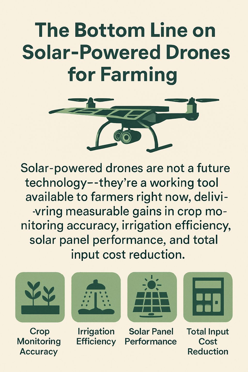
Solar-powered drones are not a future technology — they’re a working tool available to farmers right now, delivering measurable gains in crop monitoring accuracy, irrigation efficiency, solar panel performance, and total input cost reduction. The combination of extended flight times, advanced sensor payloads, and AI-driven data analysis means that a single drone system can replace days of manual scouting labor while generating higher-quality, more actionable information than any ground-based method can produce.
The farms that adopt this technology early are building a data advantage that will compound season over season — better baselines, better trend analysis, and faster decision-making at every stage of the growing cycle. The entry cost is real, but so is the return, and for operations of any meaningful scale, the question is no longer whether drone technology pays for itself — it’s which system fits your operation best and how quickly you can put it to work.
Frequently Asked Questions
Here are the most common questions farmers ask when evaluating solar-powered drone technology for their operations — answered directly and without the marketing noise.
How much does a solar-powered agricultural drone cost?
Agricultural Drone Cost Ranges (2024):
• Entry-Level Survey Drones (e.g., Parrot Anafi Ai): $2,000–$5,000
• Mid-Range Multispectral Systems (e.g., senseFly eBee Ag): $10,000–$25,000
• Professional Fixed-Wing Solar UAVs: $30,000–$80,000+
• Heavy-Lift Spray Platforms (e.g., DJI Agras T40): $15,000–$40,000
• Annual Software & Data Processing Subscriptions: $500–$3,000/year depending on platform
The wide price range reflects genuine differences in capability rather than marketing tiers. A $5,000 survey drone with a multispectral sensor can deliver real value on a 200-acre operation. A $60,000 fixed-wing solar UAV is designed for operations covering thousands of acres where flight endurance and autonomous mission capability justify the investment.
Beyond the purchase price, factor in sensor costs — multispectral cameras like the MicaSense RedEdge-P add $8,000–$15,000 to your system cost independently of the drone platform itself. LiDAR units suitable for agricultural mapping start around $5,000 and scale well above $20,000 for high-accuracy systems. These are significant line items that need to be included in any honest return-on-investment calculation.
Drone-as-a-service (DaaS) models are an increasingly practical alternative for operations that need the data without the capital investment. Third-party agricultural drone service providers can conduct seasonal surveys and deliver processed field maps at a per-acre rate — typically ranging from $2 to $10 per acre depending on sensor type and data deliverables — allowing smaller operations to access the same data quality without owning the hardware.
Whichever path you choose, calculate payback against specific, measurable outcomes: reduced scouting labor hours, input cost reduction from variable-rate application, water savings from irrigation optimization, or early pest detection that prevented a treatment delay. Farms that frame the investment this way consistently find that mid-range drone systems pay back within two to three growing seasons on operations of 500 acres or more.
Can solar drones operate in cloudy or low-light conditions?
Solar Drone Performance by Weather Condition:
• Full Sun: Maximum solar input — full hybrid operation with solar supplementing battery
• Partial Cloud Cover: Reduced solar input — battery draw increases, flight time moderately reduced
• Heavy Overcast: Minimal solar contribution — drone operates primarily on battery, flight time approaches non-solar baseline
• Rain / Active Storm: Flight not recommended regardless of power source — sensor performance and safety compromised
Yes, solar drones can fly in cloudy conditions — but the solar contribution to flight endurance decreases proportionally with available sunlight. A fixed-wing solar UAV that achieves four hours of flight time under full sun might deliver two to two and a half hours under moderate overcast, as the onboard battery carries more of the power load when solar panels can’t generate at full capacity.
The practical implication for farm planning is straightforward: schedule high-priority large-area surveys for clear or partly cloudy days when solar endurance is maximized, and use overcast days for shorter targeted flights that don’t require full-field coverage. Most agricultural drone software includes mission planning tools that let you calculate estimated flight coverage based on battery capacity alone — giving you a reliable fallback endurance figure to plan around regardless of weather.
It’s also worth noting that certain sensors actually perform better under diffuse light conditions. Multispectral sensors used for NDVI mapping can produce more consistent readings on lightly overcast days because even, diffuse lighting eliminates the shadow interference that direct sunlight creates across tall canopy crops. So while heavy cloud cover reduces solar endurance, mild overcast can actually improve data quality for specific sensor types — making it a usable condition rather than a lost flying day.
Current solar drone technology does face real limitations in payload capacity and solar panel efficiency under suboptimal conditions, and manufacturers are actively working on next-generation thin-film solar cells with higher energy conversion efficiency in low-light environments. For now, planning flight schedules around weather forecasts and maintaining a clear understanding of your drone’s battery-only endurance floor gives you reliable operational flexibility across most growing season conditions.
How accurate is drone crop monitoring compared to manual scouting?
Drone-based crop monitoring consistently outperforms manual scouting in both coverage and early detection accuracy. A trained agronomist walking a field can assess what’s visible at ground level — but multispectral sensors detect physiological stress signatures at the cellular level, identifying problems one to three weeks before visible symptoms appear. Manual scouting also suffers from sampling bias — a field walker covers a small fraction of total acreage and may miss localized problem zones entirely, while a drone survey captures the entire field at uniform resolution in a single pass.
That said, drone data and ground-level scouting work best as complementary tools rather than direct replacements. Drone imagery identifies where to look; an agronomist on the ground confirms what the problem actually is and determines the appropriate response. The combination of aerial anomaly detection with targeted ground verification is faster, more accurate, and more cost-effective than either method used in isolation.
Do farmers need special permits to fly agricultural drones?
In the United States, agricultural drone operations fall under FAA regulations. Drones weighing more than 0.55 lbs (250g) must be registered with the FAA, and commercial agricultural drone operations — meaning any flight conducted for business purposes, including on your own farm — require the operator to hold an FAA Part 107 Remote Pilot Certificate. Part 107 certification involves passing a knowledge test at an FAA-approved testing center, covering airspace classification, weather, emergency procedures, and drone operating rules. Most farmers who intend to operate drones regularly find the certification process straightforward, with study materials and practice exams widely available online. Operations requiring flights beyond visual line of sight (BVLOS) — relevant for large-scale automated survey missions — require additional FAA waivers beyond the standard Part 107 certificate.
How do solar drones help reduce a farm’s carbon footprint?
The carbon footprint reduction from solar agricultural drones comes from several directions simultaneously. Most directly, replacing fossil fuel-powered scouting vehicles and inspection equipment with solar UAVs eliminates the direct emissions associated with those tasks. A farm that conducts weekly field scouting by ATV or truck across large acreage generates measurable fuel consumption and associated emissions over a full growing season — emissions that drop to near zero when those same scouting missions are handled by a solar drone.
The more significant carbon benefit, however, is indirect — it comes from the precision that drone data enables. When variable-rate fertilizer prescriptions reduce total nitrogen application across a field, they reduce the emissions associated with fertilizer manufacturing, transportation, and soil nitrogen cycling (which produces nitrous oxide, a greenhouse gas with roughly 270 times the warming potential of CO₂ over a 100-year period). Reducing synthetic nitrogen use through precision application is one of the highest-leverage carbon reduction strategies available in row crop agriculture.
Water reduction compounds this further. Pumping water is energy-intensive, and on farms relying on electric pumps powered by grid electricity, every gallon saved reduces the energy demand placed on the grid. For farms running solar-powered irrigation, drone-optimized water use means the same solar array can cover more productive capacity — effectively extending the carbon offset value of the solar installation without adding hardware.

Leave a Reply