
Key Takeaways
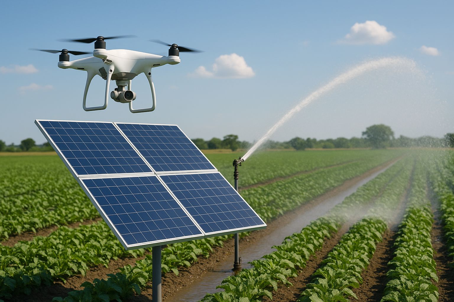
- Drones equipped with specialized sensors can reduce irrigation water usage by up to 30% while improving crop yields through precise monitoring and management
- Solar-powered irrigation systems monitored by drones provide both environmental benefits and significant cost savings for farmers of all scales
- GrowingSolarMist’s drone integration solutions help farmers transition to more sustainable and efficient irrigation practices with minimal training
- Real-time thermal imaging from agricultural drones can detect irrigation issues before they become visible to the naked eye
- Strategic drone deployment creates detailed irrigation maps that optimize water distribution across fields with varying soil conditions and crop needs
Agricultural technology is entering a new era where the sky meets the soil. Drone technology integrated with solar irrigation systems is transforming how farmers manage water resources while reducing their environmental footprint. This revolutionary approach brings precision and efficiency to one of farming’s most critical operations.
Drones Transform Solar Irrigation Management
Modern agriculture faces increasing pressure to produce more food with fewer resources. Water scarcity, energy costs, and environmental concerns push farmers to adopt innovative solutions. Drone technology paired with solar irrigation systems addresses these challenges head-on by creating a sustainable, data-driven approach to water management. GrowingSolarMist has pioneered the integration of these technologies, helping farmers transition to more efficient irrigation practices while maintaining their focus on productivity.
The convergence of drone technology and solar irrigation isn’t just about embracing new gadgets—it represents a fundamental shift in agricultural resource management. By harnessing the sun’s energy to power both irrigation systems and the drones that monitor them, farmers create a self-sustaining cycle of efficiency. This symbiotic relationship eliminates fossil fuel dependence while providing unprecedented insights into crop water needs.
How Drones Revolutionize Irrigation Monitoring
Traditional irrigation monitoring relies on manual field inspections, often leading to delayed responses to water stress and inefficient resource allocation. Drones upend this approach by providing a bird’s-eye view of entire fields within minutes rather than hours or days. Equipped with specialized cameras and sensors, agricultural drones detect moisture variations, plant stress, and irrigation system performance in real-time.
These aerial scouts identify issues like clogged emitters, uneven water distribution, or system leaks that might otherwise go unnoticed until crop damage occurs. The result is a proactive rather than reactive approach to irrigation management, allowing farmers to address problems before they impact yield. For solar irrigation systems specifically, drones can simultaneously monitor both water distribution patterns and solar panel performance, ensuring the entire system operates at peak efficiency.
Real-Time Data Collection Capabilities
The power of drone technology in irrigation management lies in its ability to collect massive amounts of actionable data rapidly. Modern agricultural drones capture multispectral, thermal, and visual imagery that reveals information invisible to the human eye. This data transforms into detailed maps showing crop water stress, soil moisture content, and irrigation coverage patterns across entire fields.
Thermal imaging particularly revolutionizes irrigation management by displaying temperature variations that directly correlate with water content. Since properly irrigated plants maintain lower temperatures through transpiration, areas with inadequate irrigation appear warmer in thermal images. This capability allows farmers to identify dry spots with pinpoint accuracy before visible wilting occurs, preventing yield loss and water waste.
“When we implemented drone monitoring for our 200-acre solar irrigation system, we reduced water usage by 27% while increasing yield by 15% in the first season. The return on investment was realized within nine months.” — James Woodson, Central Valley Almond Grower
Advanced drones integrate with weather data and soil moisture sensors to provide comprehensive irrigation insights. By combining real-time atmospheric conditions with ground-truth measurements and aerial observations, these systems create a three-dimensional understanding of a farm’s water needs. This multi-layered approach ensures irrigation decisions are based on complete information rather than limited sampling or subjective assessments.
Automated Inspection vs. Manual Methods
The contrast between drone-based monitoring and traditional manual methods becomes stark when considering efficiency and accuracy. A single worker might require days to visually inspect irrigation lines across hundreds of acres, with limited ability to detect subsurface issues or subtle stress patterns. In contrast, a drone can survey the same area in under an hour, generating detailed maps that highlight problems with centimeter-level precision.
Manual inspections also introduce human variability and subjective judgment into the assessment process. Two different inspectors might evaluate the same irrigation system differently based on experience, fatigue, or observation skills. Automated drone inspections eliminate this variability through consistent, objective measurement protocols. Every square foot receives identical scrutiny regardless of field location, time of day, or operator fatigue.
The economic implications of this efficiency extend beyond labor savings. Early detection of irrigation issues prevents crop loss, reduces water waste, and extends the lifespan of expensive irrigation infrastructure. When solar panels power these systems, drone monitoring ensures optimal energy capture and utilization, maximizing the return on investment for both the irrigation and energy-production components.
Essential Drone Equipment for Solar Irrigation Monitoring
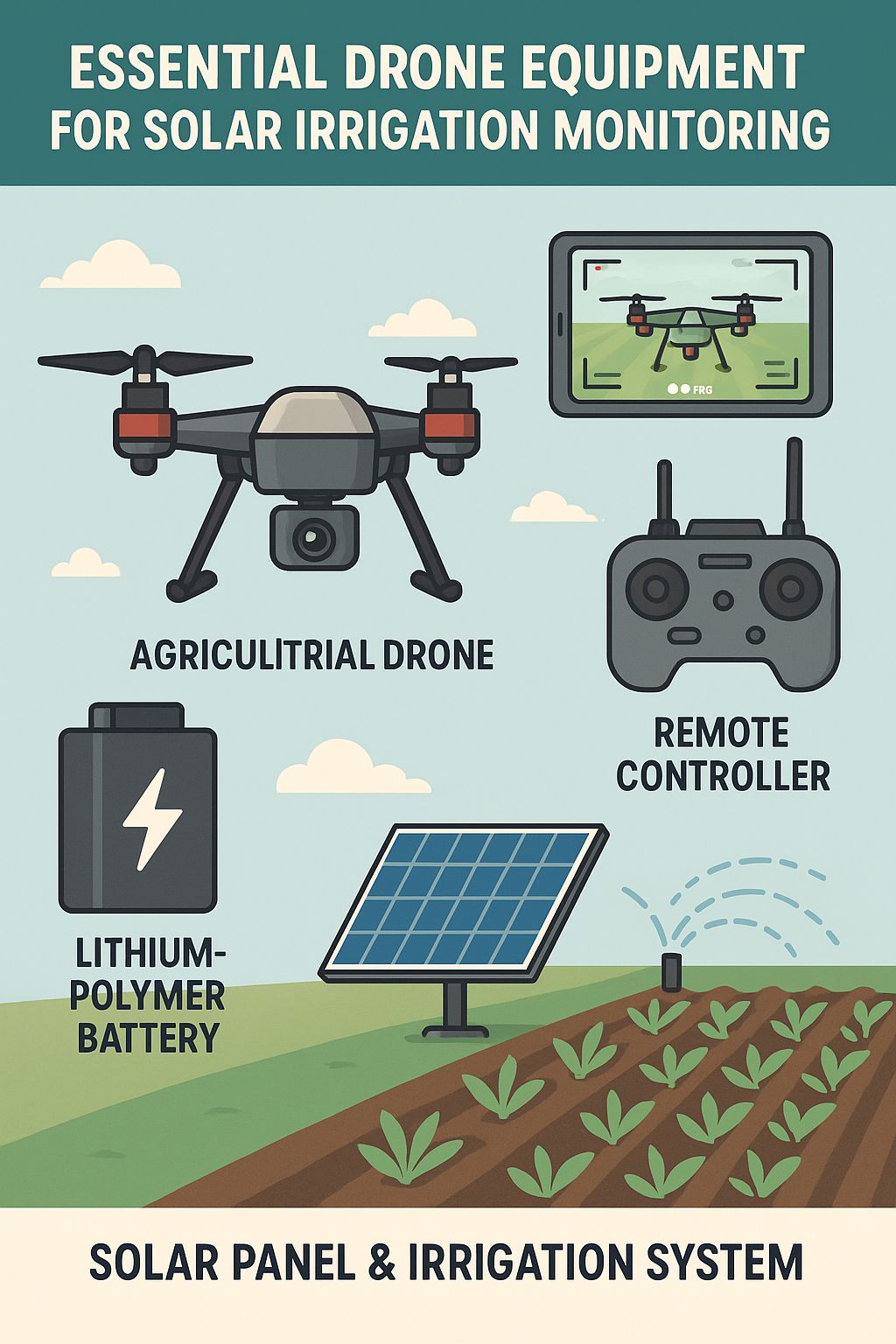
Selecting the right drone for solar irrigation monitoring requires careful consideration of several key factors. The ideal system balances flight time, sensor capabilities, durability, and ease of use. While consumer drones might seem attractive for their lower price points, agricultural applications demand specialized equipment designed for the unique challenges of farm environments and data collection needs. For those interested in enhancing their farm’s irrigation system, exploring ways to increase solar panel efficiency can be beneficial.
Best Drone Models for Agricultural Inspection
Agricultural drones fall into two main categories: multirotor and fixed-wing. Multirotor drones offer superior maneuverability and the ability to hover in place for detailed inspection of specific irrigation components. Fixed-wing models provide extended flight times and can cover larger areas more efficiently, making them ideal for expansive operations. Many farmers ultimately opt for both types to leverage their complementary strengths.
- DJI Matrice 300 RTK: Offers exceptional stability in windy conditions with up to 55 minutes of flight time and IP45 water resistance rating
- senseFly eBee X: Fixed-wing drone covering up to 500 acres in a single flight with specialized agricultural mapping capabilities
- Parrot Bluegrass Fields: Purpose-built agricultural quadcopter with multispectral sensors designed specifically for crop analysis
- AgEagle RX-48: Rugged fixed-wing platform with thermal and multispectral capabilities for large-scale operations
- DJI Phantom 4 Multispectral: Entry-level option combining accessibility with specialized agricultural sensors
When evaluating drone models, farmers should prioritize platforms with RTK (Real-Time Kinematic) positioning, which provides centimeter-level accuracy for creating precise, repeatable flight paths. This precision ensures consistent data collection over time, allowing for accurate comparison of irrigation performance across different dates. Additionally, look for drones with automated mission planning capabilities that simplify the creation of efficient flight patterns.
Camera and Sensor Requirements
The heart of any agricultural drone system lies in its sensors and cameras. For effective solar irrigation monitoring, a combination of visual, multispectral, and thermal sensors provides the most comprehensive data. RGB cameras with 20MP resolution or higher deliver detailed visual imagery for identifying physical damage or blockages in irrigation infrastructure. This visual baseline helps farmers spot obvious issues like broken sprinkler heads or downed solar panels.
Multispectral sensors capture data beyond what human eyes can perceive, measuring light reflection across multiple bands of the electromagnetic spectrum. These sensors calculate vegetation indices like NDVI (Normalized Difference Vegetation Index) that quantify plant health and water stress. The ability to detect crop stress before visual symptoms appear gives farmers a critical advantage in irrigation management, allowing adjustments before yield loss occurs.
Thermal sensors are perhaps the most valuable tools for irrigation monitoring, detecting temperature variations as small as 0.1°C. Since water-stressed plants exhibit higher canopy temperatures than well-watered ones, thermal imagery creates a precise map of irrigation effectiveness across entire fields. These sensors also excel at identifying leaks in irrigation lines, which appear as cooler zones where water saturates surrounding soil.
Battery Life and Flight Time Considerations
Effective irrigation monitoring requires sufficient flight time to cover entire agricultural operations in a single mission. Battery limitations represent one of the most significant constraints in drone technology, with most multirotor models offering 20-40 minutes of flight time per battery. For large-scale operations, this necessitates either multiple batteries with a charging station or selection of fixed-wing drones that can achieve 90+ minutes of flight time.
Many agricultural drone operators integrate solar charging stations into their operations, creating synergy with existing solar irrigation infrastructure. These stations allow for autonomous recharging between missions, maximizing the drone’s daily coverage without constant operator intervention. Solar-powered drones themselves represent an emerging technology, though current models still face limitations in payload capacity compared to battery-powered alternatives.
Flight time requirements should be calculated based on field size, desired image resolution, and flight speed. Higher resolution imaging requires slower flights at lower altitudes, reducing the area covered per battery. Most agricultural operations find that maintaining 1-2 cm/pixel resolution provides the ideal balance between detail and efficiency for irrigation monitoring purposes.
Weather-Resistant Features for Farm Conditions
Agricultural environments present unique challenges for drone technology, including dust, moisture, heat, and wind. Professional agricultural drones incorporate IP-rated weather resistance (typically IP43 to IP55) to withstand these conditions. This protection shields sensitive electronics from dust ingress and water exposure, extending the drone’s operational lifespan and reliability.
Wind resistance represents another critical specification, with quality agricultural drones maintaining stable flight in winds up to 25-30 mph. This capability ensures consistent data collection even in less-than-ideal conditions, an important consideration given the time-sensitive nature of irrigation management decisions. Some models incorporate active wind compensation technology that automatically adjusts flight parameters to maintain position and image quality.
Temperature tolerance matters significantly in agricultural settings where summer field temperatures can exceed 100°F. Look for drones rated to operate in temperature ranges from 14°F to 104°F (-10°C to 40°C) to ensure year-round functionality. Higher-end models include active cooling systems for their electronic components, preventing overheating during extended missions in hot conditions.
Key Inspection Points in Solar Irrigation Systems
Effective drone monitoring of solar irrigation systems requires a systematic approach focusing on critical components and potential failure points. By establishing consistent inspection protocols, farmers can detect issues before they impact crop health or system efficiency. The integration of solar power with irrigation adds complexity but also creates opportunities for comprehensive energy-water system optimization.
Panel Performance and Cleanliness Assessment
Solar panels power the entire irrigation system, making their performance fundamental to overall efficiency. Drone thermal imaging quickly identifies underperforming panels, which appear as hot spots compared to properly functioning ones. These temperature differentials often indicate electrical faults, physical damage, or manufacturing defects that require immediate attention.
Dust and debris accumulation on solar panels can reduce energy production by 15-30%, directly impacting irrigation capacity. Regular drone RGB imagery allows farmers to assess panel cleanliness without physical inspection, scheduling cleaning only when necessary rather than on arbitrary intervals. This targeted maintenance approach optimizes labor allocation while ensuring maximum energy capture.
Panel alignment and positioning issues also become apparent through drone imagery, particularly when shadows fall across portions of the array. These shadows can dramatically reduce system output, especially in tracking systems that should adjust panel angle throughout the day. Drone monitoring helps verify that tracking mechanisms function correctly and identifies when vegetation growth begins to interfere with panel exposure.
Pump and Water Flow Monitoring
Irrigation pumps represent the heart of water distribution systems, and their failure can rapidly lead to crop stress. Thermal imaging drones detect pump overheating—often the earliest warning sign of impending failure—well before catastrophic breakdowns occur. Regular temperature monitoring creates baseline performance data, allowing farmers to identify gradual efficiency declines that warrant maintenance.
Water flow patterns surrounding pumping stations provide valuable diagnostic information visible from drone altitude. Unexpected pooling or moisture patterns may indicate leaks in main supply lines, while dry areas downstream can signal insufficient pressure or flow restrictions. These visual cues guide ground-level inspection efforts, eliminating guesswork in troubleshooting complex irrigation networks.
Solar-powered pumping stations present unique monitoring opportunities where drones can simultaneously assess both energy production and water distribution components. This comprehensive view enables farmers to determine whether irrigation limitations stem from power generation issues or water delivery problems, directing maintenance efforts appropriately. For those interested in optimizing their systems, exploring ways to increase solar panels’ efficiency can be beneficial.
Distribution Network Leak Detection
Irrigation system leaks waste water, reduce system pressure, and potentially damage crops through overwatering. Thermal imaging drones excel at identifying leaks since water escaping from pipes creates distinct temperature variations in surrounding soil. These thermal signatures appear even when leaks remain invisible at the surface, allowing detection of subterranean issues before they worsen.
Multispectral imaging complements thermal detection by identifying unusual vegetation growth patterns associated with leaks. Areas receiving excess water typically show higher NDVI values compared to properly irrigated zones. This vegetation-based approach proves particularly valuable for detecting slow, chronic leaks that might not create dramatic thermal signatures but still impact system efficiency over time.
Drone monitoring drastically reduces the time required to inspect extensive irrigation networks. A typical center pivot system spanning a quarter-mile radius would require hours of walking to inspect visually, while a drone can capture comprehensive thermal and visual data of the entire system in under 20 minutes. This efficiency transforms leak detection from a reactive, occasional process to a proactive, regular maintenance activity. For those interested in further enhancing irrigation efficiency, exploring solar-powered linear sprinkler systems could be beneficial.
Water Delivery Uniformity Evaluation
Uniform water application represents a fundamental goal of efficient irrigation, yet achieving it remains challenging across varied topography and soil conditions. Drone-generated NDVI maps reveal irrigation uniformity with remarkable clarity, showing precisely where water distribution falls short. These detailed maps guide adjustments to sprinkler heads, pressure regulators, or emitter specifications to achieve consistent coverage.
Temporal analysis proves particularly valuable for uniformity assessment, with sequential drone flights revealing how irrigation patterns change throughout crop development cycles. As plant canopies grow and create different microclimates, irrigation that was once uniform may develop inconsistencies. Regular monitoring allows for continuous optimization rather than one-time setup. For those interested in efficient irrigation methods, exploring solar-powered drip irrigation systems can provide insights into sustainable water management.
|
Uniformity Issue |
Drone Detection Method |
Typical Causes |
Remediation Strategy |
|---|---|---|---|
|
Edge underirrigation |
Thermal/NDVI mapping |
Insufficient overlap, wind drift |
Adjust sprinkler positioning, add end guns |
|
Donut patterns |
Thermal imaging |
Pressure issues, clogged nozzles |
Clean/replace nozzles, adjust pressure regulators |
|
Streaking |
RGB/multispectral |
Sprinkler misalignment |
Realign heads, check for physical damage |
|
Topographical dry spots |
Elevation + thermal mapping |
Pressure insufficient for elevation changes |
Install pressure boosters, redesign zones |
|
Soil variation effects |
Multitemporal NDVI |
Different soil water retention rates |
Implement variable rate irrigation |
Drone-based uniformity assessment enables the implementation of variable rate irrigation (VRI) technologies, where water application rates adjust automatically based on actual field conditions. By creating precise prescription maps from drone data, VRI systems can apply exactly the right amount of water to each field section, accommodating differences in soil type, slope, and crop variety within the same irrigation zone.
System Component Temperature Analysis
Thermal analysis of irrigation system components provides crucial insights into mechanical health and operational efficiency. Pumps, motors, valves, and electronic controllers all generate heat during normal operation, but excessive temperatures indicate potential failures. Drones equipped with high-resolution thermal cameras can detect these temperature anomalies during routine flights, enabling preventative maintenance before catastrophic failures occur.
Solar components benefit particularly from thermal monitoring since panel efficiency decreases as temperature increases. Identifying unusually hot panels or sections allows for targeted maintenance that maintains optimal energy production. Similarly, inverters and control systems that show elevated temperatures compared to baseline readings often indicate electrical issues that require immediate attention to prevent system downtime.
Creating a comprehensive temperature profile database for all system components establishes normal operating parameters against which future readings can be compared. This historical data transforms simple temperature readings into predictive maintenance tools, where gradual temperature increases over time can signal impending failures even when readings remain within absolute acceptable ranges.
Data Analysis Techniques for Irrigation Efficiency
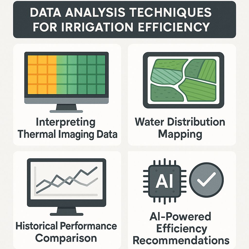
Collecting drone data represents only half the equation—turning this information into actionable insights requires sophisticated analysis techniques. Modern agricultural software platforms integrate drone imagery with other farm data sources to create comprehensive management systems that optimize irrigation decisions. These platforms continue evolving as artificial intelligence and machine learning capabilities advance.
Interpreting Thermal Imaging Data
Thermal data interpretation begins with understanding that temperature differences as small as 1-2°C can indicate significant irrigation issues. Professional analysis software applies color gradients to raw thermal data, creating intuitive visualizations where cool blues represent well-watered areas and warm reds indicate water stress. These visualizations make patterns immediately apparent even to operators without technical training in thermography.
Advanced analysis incorporates crop-specific temperature thresholds that trigger alerts when readings exceed optimum ranges. These thresholds adjust automatically based on ambient conditions, accounting for factors like air temperature, humidity, and solar radiation that influence leaf temperature independently of soil moisture. This contextual analysis prevents false alarms during naturally hot periods while ensuring genuine irrigation deficiencies receive prompt attention.
Time-series thermal analysis proves particularly valuable, comparing current conditions against historical imagery to identify persistent problem areas versus temporary stress conditions. Areas that consistently show elevated temperatures across multiple flights warrant investigation into underlying irrigation system deficiencies or soil composition issues that might require remediation beyond simple irrigation adjustments.
Water Distribution Mapping
“Before implementing drone mapping, we struggled with unexplained dry spots in our alfalfa fields despite increasing water application. Thermal mapping revealed a subtle slope causing runoff that wasn’t visible from ground level. After regrading that section, we achieved uniform growth while reducing overall water usage by 22%.” — Maria Rodriguez, Colorado Hay Producer
Water distribution mapping combines multiple data layers—thermal, multispectral, and RGB imagery—with topographical information to create comprehensive irrigation efficiency maps. These maps reveal patterns invisible from ground level, such as how slight elevation changes affect water movement or how soil variations influence moisture retention. The resulting insights enable precision adjustments to irrigation infrastructure that would be impossible based on visual inspection alone.
Quantitative distribution analysis calculates Coefficient of Uniformity (CU) values across fields, providing numerical metrics that track irrigation performance over time. These objective measurements allow farmers to evaluate whether system modifications actually improve water distribution or simply shift problems to different areas. The ability to quantify improvements justifies infrastructure investments with demonstrable efficiency gains rather than subjective assessments. For farmers interested in enhancing their irrigation systems, exploring options like a solar-powered drip irrigation system can offer efficient use of resources.
For variable rate irrigation systems, drone-generated water distribution maps translate directly into prescription files that control individual nozzles or emitters. This direct data pipeline creates a continuous improvement cycle where each irrigation event incorporates lessons from previous applications, steadily optimizing water use efficiency throughout the growing season.
Historical Performance Comparison Methods
Consistent drone monitoring creates valuable historical datasets that reveal patterns and trends invisible in single-point measurements. By flying identical routes at regular intervals, farmers build comprehensive records of irrigation performance across different weather conditions, crop growth stages, and seasons. These longitudinal datasets identify both chronic problem areas requiring infrastructure improvements and emerging issues that develop gradually over time.
Comparative analysis overlays current irrigation performance against historical benchmarks from similar conditions in previous seasons. This approach accounts for normal seasonal variations while highlighting abnormal patterns that indicate system degradation or environmental changes. Many farmers establish baseline efficiency metrics during optimal system performance, using these references to detect subtle efficiency losses before they significantly impact crop production.
Geographic information system (GIS) software facilitates these historical comparisons by precisely aligning images from different dates despite minor variations in drone position or camera angle. This spatial rectification ensures that comparisons evaluate identical field sections rather than introducing position-based errors. The resulting accurate time-series analysis supports confident decision-making based on genuine performance changes rather than data collection artifacts.
AI-Powered Efficiency Recommendations
Artificial intelligence transforms raw drone data into specific management recommendations by analyzing patterns too complex for human recognition. Machine learning algorithms trained on thousands of irrigation scenarios can identify subtle interactions between soil types, crop varieties, weather patterns, and irrigation methods that influence water use efficiency. These systems continuously improve as they incorporate more farm-specific data, becoming increasingly tailored to individual operation characteristics.
Predictive modeling leverages historical patterns to forecast irrigation needs before stress occurs, shifting water management from reactive to proactive approaches. By incorporating weather forecasts, crop growth models, and soil moisture trends, these systems recommend precise irrigation timing and volumes that maintain optimal growing conditions while minimizing water use. The resulting recommendations often challenge conventional wisdom, suggesting counter-intuitive strategies that nevertheless produce superior results. Learn more about the role of drones in farming and how they contribute to efficient irrigation practices.
Decision support systems present AI-generated recommendations through intuitive interfaces that explain both what actions to take and why they’re being suggested. This transparency builds farmer confidence in the technology while creating learning opportunities that enhance overall irrigation management expertise. The most effective systems allow for feedback and adjustment, incorporating farmer knowledge alongside algorithmic recommendations to create truly optimized irrigation strategies. To learn more about the role of drones in farming, visit this informative article.
Financial Benefits of Drone-Based Irrigation Management
The economic case for drone-based irrigation management extends far beyond simple water savings. While reduced water consumption represents an important benefit, the technology’s impact on crop yield, quality, labor efficiency, and system maintenance often delivers even greater financial returns. Understanding these comprehensive benefits helps farmers evaluate the true return on investment potential for their specific operations.
Water Usage Reduction Calculations
Drone-monitored solar irrigation systems typically reduce water consumption by 15-30% compared to conventional management approaches. For a 100-acre operation using 24 inches of irrigation water annually, this represents savings of 3.6-7.2 inches per acre, or approximately 98,000-196,000 gallons per acre annually. At water costs ranging from $20-200 per acre-foot depending on region, these savings translate to $7,500-150,000 in direct water cost reductions for the entire operation.
Beyond direct water costs, reduced pumping translates to lower energy requirements for the entire system. Even solar-powered systems benefit from these reductions, as the same solar capacity can either irrigate more acreage or provide surplus energy for other farm operations. Many operations report energy savings of 20-35% after implementing drone-guided irrigation optimization, extending the effective capacity of existing solar installations.
The environmental value of water conservation adds another dimension to these calculations, particularly in regions facing water scarcity or regulatory restrictions. Operations demonstrating reduced water consumption often receive preferential treatment in water allocation decisions during drought conditions. Some regions also offer financial incentives or tax benefits for implementing water conservation technologies, further enhancing the economic return.
Energy Consumption Savings
|
Farm Size (acres) |
Traditional Irrigation Energy Cost |
Drone-Optimized Solar System Energy Cost |
Annual Savings |
10-Year Savings |
|---|---|---|---|---|
|
50 |
$12,500 |
$1,500 |
$11,000 |
$110,000 |
|
100 |
$25,000 |
$3,000 |
$22,000 |
$220,000 |
|
500 |
$125,000 |
$15,000 |
$110,000 |
$1,100,000 |
|
1,000 |
$250,000 |
$30,000 |
$220,000 |
$2,200,000 |
Solar irrigation systems dramatically reduce energy costs compared to conventional electric or fossil fuel pumping, but their efficiency depends on proper sizing and operation. Drone monitoring ensures these systems perform optimally, extending the effective capacity of solar installations through precise water application. Many operations find they can reduce solar panel capacity by 15-20% when combining solar power with drone-optimized irrigation management, representing significant capital cost savings during system installation.
For hybrid systems that supplement solar with conventional power during peak demand, drone optimization often eliminates the need for supplemental energy entirely. By distributing irrigation more efficiently throughout the day and prioritizing zones based on actual need rather than arbitrary scheduling, these systems maximize utilization of available solar production. The resulting energy independence not only reduces costs but also enhances operational reliability by eliminating dependence on external power sources.
Labor Cost Reduction
Manual irrigation monitoring and management typically requires 1.5-3 hours per acre annually across all irrigation events. Drone automation reduces this labor requirement by 60-80%, freeing skilled workers for higher-value tasks. For a 100-acre operation, this represents 90-240 hours of annual labor savings, translating to $2,250-7,200 at agricultural labor rates of $15-30 per hour.
The quality of remaining irrigation management labor also transforms, shifting from physically demanding field inspections to higher-skilled data analysis and decision-making roles. This evolution creates opportunities for workforce development and retention, addressing the agricultural labor shortage by offering more technically advanced positions that attract and retain skilled employees. Many operations report improved worker satisfaction and reduced turnover after implementing drone-based management systems.
Perhaps most significantly, drone automation reduces the management burden on farm owners and senior staff, allowing them to oversee larger operations without proportional increases in time commitment. This scalability enables business growth without corresponding increases in management complexity, supporting expansion that would be impractical under conventional monitoring approaches. For family operations, this often translates to improved quality of life alongside enhanced profitability.
Crop Yield Improvements Through Optimized Irrigation
Precision irrigation management consistently delivers yield increases of 7-15% across most crop types, with some specialized crops showing improvements up to 25%. These gains result from maintaining optimal soil moisture throughout the growing season, eliminating both water stress and overwatering that limit plant productivity. For crops with current yields valued at $1,000 per acre, a 10% improvement represents an additional $100 per acre in revenue—often exceeding the entire cost of drone monitoring within a single growing season.
Beyond raw yield increases, optimized irrigation often improves crop quality characteristics that command market premiums. Fruits and vegetables show better color development, higher sugar content, and improved texture when irrigation precisely matches plant needs throughout development. Similarly, optimized irrigation in grain crops can increase protein content and reduce defects, potentially accessing premium markets unavailable to conventionally irrigated products.
Irrigation timing precision enabled by drone monitoring also supports harvest optimization, ensuring crops reach ideal moisture content for mechanical harvesting or market delivery. This synchronization reduces harvest losses and quality degradation, particularly in crops where timing significantly impacts storability or processing characteristics. The resulting improvements in marketable yield often exceed the direct production increases, multiplying the economic benefit of the monitoring system.
Step-by-Step Drone Inspection Protocol
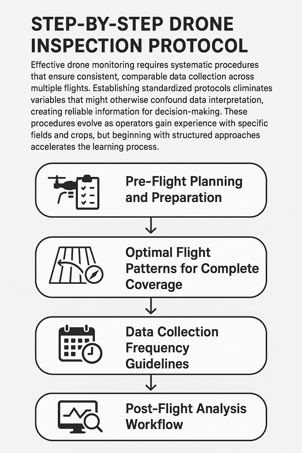
Effective drone monitoring requires systematic procedures that ensure consistent, comparable data collection across multiple flights. Establishing standardized protocols eliminates variables that might otherwise confound data interpretation, creating reliable information for decision-making. These procedures evolve as operators gain experience with specific fields and crops, but beginning with structured approaches accelerates the learning process.
Pre-Flight Planning and Preparation
Successful drone missions begin with thorough planning that considers flight objectives, environmental conditions, and equipment requirements. Mission planning software allows operators to define precise flight paths, altitudes, and image capture parameters that ensure complete coverage of irrigation systems. These plans should establish consistent parameters across missions to facilitate accurate temporal comparisons, including standardized takeoff locations, flight altitudes, and image overlap percentages.
Equipment preparation includes battery charging, sensor calibration, and preflight checklists that verify all components function correctly. Thermal sensors particularly benefit from pre-flight calibration to ensure accurate temperature readings, ideally including reference targets with known temperatures within the flight area. Similarly, multispectral sensors require calibration panels that establish baseline reflectance values for accurate vegetation index calculations.
Weather conditions significantly impact data quality, with ideal flights occurring on clear days with minimal wind and consistent sunlight. For thermal imaging specifically, flights should occur during periods of maximum plant stress—typically early afternoon when temperature differentials between properly irrigated and water-stressed plants reach their maximum. Planning should include alternative mission dates when forecast conditions might compromise data quality. For more insights, explore the role of drones in farming.
Optimal Flight Patterns for Complete Coverage
Grid patterns with 75-80% image overlap provide optimal coverage for irrigation monitoring, ensuring sufficient data redundancy for accurate stitching while maximizing flight efficiency. These high overlap percentages compensate for subtle drone positioning variations and ensure every part of the irrigation system appears in multiple images, eliminating blind spots that might miss critical issues. For larger fields, dividing the area into multiple flight segments maintains consistent image resolution while accommodating battery limitations.
Flight altitude balances resolution requirements against coverage efficiency, with most agricultural monitoring occurring between 60-120 meters above ground level. Lower altitudes provide higher resolution imagery but require more flight time to cover equivalent areas. Many operations establish different altitude protocols for general monitoring versus detailed inspection, using higher altitude overviews to identify potential problem areas that warrant closer examination in subsequent flights.
Specialized flight patterns target specific irrigation components, with linear paths following irrigation lines for pipe inspection and circular patterns centered on pivot systems. These targeted approaches maximize relevant data collection while minimizing flight time. Some advanced protocols incorporate adaptive flight patterns that automatically adjust based on real-time data, concentrating detailed imaging on areas showing potential anomalies while maintaining broader coverage elsewhere.
Data Collection Frequency Guidelines
|
Crop Type |
Growth Stage |
Weather Conditions |
Recommended Frequency |
Primary Data Focus |
|---|---|---|---|---|
|
Row Crops |
Early Vegetative |
Normal |
Weekly |
Emergence uniformity, early stress detection |
|
Row Crops |
Critical Growth Periods |
Normal |
Every 3-4 days |
Water stress prevention, real-time adjustments |
|
Tree Crops |
Fruit Development |
Normal |
Every 5-7 days |
Moisture consistency, preventing fruit drop |
|
Any Crop |
Any Stage |
Heat Wave |
Daily |
Preventing critical stress, emergency intervention |
|
Any Crop |
Post-Irrigation |
Any |
12-24 hours after |
Distribution uniformity, system performance |
Monitoring frequency should align with crop sensitivity and growth stage, with most operations establishing variable schedules throughout the season. Critical growth periods—such as flowering, fruit set, or grain fill—warrant more frequent monitoring than vegetative growth stages. Similarly, sensitive crops like berries or leafy greens typically require more frequent assessment than drought-tolerant options like mature tree crops or certain grain varieties.
Weather conditions significantly influence optimal monitoring frequency, with high temperatures, low humidity, or strong winds accelerating crop water use and increasing stress risks. During these high-demand periods, daily monitoring might be necessary to prevent yield-limiting stress, while cooler, humid conditions might allow monitoring intervals to extend to 5-7 days. Integrating weather forecasts into monitoring schedules helps anticipate these changing requirements.
System-focused monitoring complements crop-focused assessments, with dedicated flights examining irrigation infrastructure functionality. These inspections typically occur monthly during the growing season and immediately following any system modifications or repairs. Some operations also conduct comprehensive system evaluations at the beginning and end of each growing season to document changes in performance over time and identify winter maintenance priorities.
Post-Flight Analysis Workflow
Effective data processing transforms raw drone imagery into actionable irrigation intelligence through a structured workflow that ensures consistency and quality. Initial processing includes image stitching, georeferencing, and radiometric corrections that create standardized base maps for subsequent analysis. These foundational steps require specialized software but increasingly automate through cloud processing services that reduce computational demands on farm equipment. For more insights on enhancing efficiency, explore how to increase solar panels’ efficiency for farm irrigation systems.
Analysis techniques vary by sensor type, with thermal data requiring temperature extraction and normalization against ambient conditions, while multispectral processing focuses on vegetation index calculations. These specialized analyses often occur in separate software environments before integration into comprehensive management platforms. The most efficient workflows automate these technical processes while allowing operator input for quality control and context-specific interpretation.
Results visualization represents the critical final step, translating complex data into intuitive formats accessible to decision-makers. Interactive maps with toggleable layers allow exploration of different data types, while automated reporting highlights significant findings and recommended actions. Many systems now integrate mobile applications that deliver these visualizations directly to operators in the field, facilitating immediate implementation of irrigation adjustments based on current conditions.
Regulatory Considerations for Agricultural Drone Use
Agricultural drone operations must navigate evolving regulatory frameworks that balance innovation with safety and privacy concerns. Understanding these requirements prevents costly compliance issues while ensuring sustainable integration of drone technology into farm management systems. Regulations continue evolving as drone use expands, requiring ongoing attention to changing requirements.
FAA Requirements for Farm Drone Operations
In the United States, the Federal Aviation Administration (FAA) regulates all drone operations through Part 107 rules that establish pilot certification requirements, aircraft registration procedures, and operational limitations. Agricultural operators must obtain Remote Pilot Certification by passing a knowledge test covering airspace regulations, weather interpretation, drone performance, and emergency procedures. This certification requires renewal every 24 months through a recurrent knowledge test that updates pilots on changing regulations.
Operational restrictions include maintaining visual line of sight with the drone, flying below 400 feet above ground level, avoiding operations over non-participants, and yielding right-of-way to manned aircraft. While these requirements generally accommodate agricultural monitoring, they can limit operations on larger farms where beyond-visual-line-of-sight capabilities would enhance efficiency. Waivers for specific restrictions are available through formal application processes, with agricultural operations increasingly receiving approvals for expanded capabilities based on established safety records.
State-Specific Agricultural Drone Regulations
Beyond federal requirements, many states implement additional regulations affecting agricultural drone operations, particularly regarding data collection, privacy protections, and land access rights. These regulations vary significantly by location, with some states explicitly protecting farm data as proprietary information while others establish specific notification requirements before conducting aerial surveys. Farm operators should consult state agricultural departments and aviation authorities for location-specific guidance.
Environmental restrictions present additional considerations in certain regions, particularly regarding wildlife disturbance, protected habitat overflights, or operations near water bodies. These restrictions often involve seasonal limitations rather than outright prohibitions, allowing operations outside sensitive periods. Working with local environmental agencies during system planning helps identify these constraints and develop compliant monitoring protocols.
Privacy Concerns When Flying Over Multiple Properties
Agricultural operations frequently span property boundaries or neighbor residential areas, creating potential privacy concerns when drone monitoring extends beyond owned land. While airspace regulations technically permit flights over adjacent properties, responsible operations require consideration of neighbor concerns and potential data collection limitations. Many successful operations establish proactive communication with neighboring landowners, explaining monitoring objectives and addressing concerns before implementing regular flight programs.
Data management policies should explicitly address information collected beyond operational boundaries, establishing clear protocols for handling incidental imagery of adjacent properties. These policies typically include provisions for data segregation, restricted access to sensitive information, and defined retention periods that limit long-term storage of non-essential imagery. Transparent communication of these policies helps build community acceptance of agricultural drone operations.
Collaborative approaches often prove most effective, with some regions establishing cooperative monitoring programs where multiple landowners share drone services and resulting data. These arrangements distribute costs while addressing privacy concerns through mutual participation and data sharing agreements. Such collaborations frequently expand to include irrigation districts, conservation agencies, and agricultural extension services that provide additional technical support and regulatory guidance.
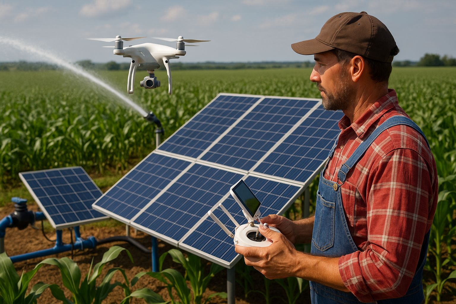
Maximize Your Farm’s Efficiency with Drone Technology
The integration of drone technology with solar irrigation systems represents not merely an incremental improvement but a fundamental transformation in agricultural water management. By combining aerial monitoring capabilities with renewable energy systems, farmers simultaneously address water conservation, energy independence, and operational efficiency challenges. This synergistic approach delivers environmental benefits alongside significant economic advantages, positioning operations for long-term sustainability.
Implementation strategies should follow staged approaches that build capabilities progressively rather than attempting comprehensive deployment immediately. Many successful operations begin with contracted drone services that demonstrate value before investing in equipment and training. This approach allows farmers to evaluate benefits in their specific context while learning from service providers’ expertise. As operations develop internal capabilities, these relationships often evolve into technical support arrangements that supplement in-house monitoring programs.
Is it a Good Investment for a Farmer to Use Drones to help with the Farm’s Efficiency
For most irrigation-dependent operations, drone technology represents one of the highest-return agricultural investments available today, with typical payback periods of 1-3 seasons depending on farm size, crop value, and water costs. The combined benefits of water savings, yield improvements, labor reduction, and system optimization frequently deliver annual returns exceeding 300% of implementation costs. When integrated with solar irrigation systems, these returns compound through extended system lifespan and enhanced energy efficiency that further improve the economic equation.
Frequently Asked Questions
As farmers explore drone technology for irrigation management, certain questions consistently arise regarding implementation, capabilities, and practical considerations. The following responses address these common concerns based on actual field experience and documented results across diverse agricultural operations.
How much does a quality agricultural inspection drone cost?
Entry-level agricultural drones with basic RGB and NDVI capabilities typically range from $1,500-5,000, providing sufficient functionality for smaller operations or initial monitoring programs. These systems generally include automated flight planning software, basic analysis capabilities, and camera systems adequate for detecting major irrigation issues and crop stress patterns. While lacking the precision of more advanced options, these systems often deliver 70-80% of potential benefits at significantly lower cost points.
Professional-grade systems with integrated thermal, multispectral, and high-resolution RGB sensors range from $8,000-25,000 depending on sensor quality, flight time, and data processing capabilities. These comprehensive platforms provide the detailed information necessary for precision irrigation management across diverse crops and conditions. For operations exceeding 100 acres or growing high-value crops, these systems typically deliver the best return on investment through superior data quality and reliability.
Do I need special training to operate a drone for irrigation inspection?
Beyond required FAA certification, effective agricultural drone operation requires training in flight planning, data collection protocols, and irrigation-specific analysis techniques. Most manufacturers offer basic operational training, while agricultural extension services increasingly provide specialized courses in agricultural applications. GrowingSolarMist provides comprehensive training programs specifically designed for irrigation monitoring that combine technical drone operation with agricultural interpretation skills, accelerating the learning curve for new operators.
Can drones detect underground irrigation leaks?
- Surface manifestations: Drones can detect moisture patterns, vegetation changes, and thermal signatures that indicate underground leaks even before water reaches the surface
- Depth limitations: Detection reliability decreases with depth, with most systems effectively identifying issues up to 18-24 inches below the surface
- Soil factors: Detection capabilities vary by soil type, with clay soils showing clearer surface indications than sandy soils where water disperses more rapidly
- Timing considerations: Early morning flights often provide clearer thermal signatures of underground leaks due to temperature differentials between leaked water and surrounding soil
While drones cannot directly “see” underground, they excel at detecting the surface effects of subsurface leaks through multiple data types. Thermal imaging identifies temperature differences created by water cooling the soil above leaks, while multispectral sensors detect vegetation changes resulting from increased moisture. RGB imagery captures visual cues like subtle soil color changes or unexpected plant growth patterns along buried lines.
Detection capabilities improve significantly when combining current imagery with historical data that establishes baseline conditions. By comparing current patterns against known system layouts and previous monitoring results, analysis software identifies anomalies that likely indicate developing problems. This comparative approach proves particularly valuable for detecting slow leaks that might not create dramatic single-point signatures. For more information on efficient irrigation, check out this solar-powered drip irrigation system.
For comprehensive underground system evaluation, many operations supplement drone monitoring with ground-based moisture sensors at critical junctions or vulnerable segments. This hybrid approach leverages drone efficiency for broad coverage while deploying targeted ground sensors where precision is most critical. The resulting integrated monitoring system provides both early warning capabilities and precise location information for efficient repair planning.
How often should I conduct drone inspections of my solar irrigation system?
Most successful operations establish tiered monitoring schedules that include weekly crop-focused flights during peak growth periods, bi-weekly system performance assessments, and monthly comprehensive infrastructure evaluations. This approach balances data collection needs against operational efficiency, concentrating resources where they deliver maximum value. Scheduling should adjust based on weather conditions, crop development stages, and any observed system irregularities that warrant increased scrutiny. For more on optimizing your system, explore our guide on increasing solar panels efficiency.
What weather conditions prevent effective drone irrigation inspections?
Rain and high winds (typically above 15-20 mph) present the most common limitations for drone operations, affecting both flight safety and data quality. Precipitation interferes with sensor readings while creating temporary surface moisture patterns that mask underlying irrigation conditions. Strong winds challenge flight stability while potentially creating artificial patterns in thermal imagery as wind-cooled surfaces create false indicators of moisture variation.
Cloud cover affects different monitoring objectives differently, with RGB and multispectral imaging requiring relatively consistent illumination for accurate results. Thermal imaging actually benefits from overcast conditions that minimize solar heating variations across the field, though complete cloud cover reduces overall thermal contrast. Ideal thermal imaging conditions typically include either consistent full sun or consistent complete cloud cover rather than intermittent patterns.
- Precipitation: Avoid flights during active rainfall and for 12-24 hours following significant precipitation events
- Wind: Limit operations when sustained winds exceed 15 mph or gusts exceed 20 mph
- Temperature extremes: Very high temperatures (above 95°F/35°C) can affect drone battery performance and sensor accuracy
- Fog or smoke: Particulates in the air significantly degrade image quality and can interfere with drone navigation systems
- Rapidly changing light conditions: Quick-moving clouds create inconsistent illumination that complicates multispectral analysis
Weather planning tools integrated with flight management software help identify optimal monitoring windows based on forecast conditions. These systems increasingly incorporate predictive modeling that balances weather limitations against monitoring priorities, suggesting optimal flight timing that maximizes data quality while maintaining regular assessment schedules. For critical monitoring periods, many operations maintain contingency plans that include abbreviated flight patterns focusing on highest-priority areas when weather windows are limited.
Time of day significantly influences data quality, particularly for thermal imagery where early afternoon typically provides maximum contrast between properly irrigated and water-stressed areas. Morning flights often reveal irrigation system performance from previous evening applications, while mid-day flights best indicate current crop stress conditions. Many comprehensive programs include multiple daily flights during critical periods to capture both system performance and resulting crop response.
Drones have revolutionized the way farmers approach irrigation, making it more efficient and sustainable. By using drones, farmers can monitor their crops and optimize water usage, ensuring that every drop counts. This technology, when combined with solar-powered drip irrigation systems, allows for an even more effective use of resources, harnessing the sun’s energy to power irrigation efforts. As a result, farmers can reduce their reliance on traditional energy sources and minimize their environmental impact.

Leave a Reply